Kissimmee River
The Kissimmee Basin encompasses more than two dozen lakes in the Kissimmee Chain of Lakes (KCOL), their tributary streams and associated marshes and the Kissimmee River and floodplain. The basin forms the headwaters of Lake Okeechobee and the Everglades; together they comprise the Kissimmee-Okeechobee-Everglades (KOE) system. In the 1960s, the Central and Southern Florida Flood Control (C&SF) Project modified the native KOE system extensively throughout South Florida, including construction of canals and water control structures to achieve flood control in the Upper and Lower Kissimmee basins.
Major initiatives in the Kissimmee Basin include the Kissimmee River Restoration Project, the Kissimmee River Restoration Evaluation Program and the Kissimmee Chain of Lakes and Kissimmee Upper Basin Monitoring and Assessment. A number of activities are associated with these projects, including ecosystem restoration, evaluation of restoration efforts, aquatic plant management, land management, water quality improvement and water supply planning.
- Real-Time Data – Current Conditions
- Environmental Monitoring
- Kissimmee Basin Maps
- Related Documents
- Photo Gallery: Kissimmee River Restoration Progress
- More Related Photos
- Photo Gallery: 2019 Kissimmee River Restoration Features
Restoring the Kissimmee River
The Kissimmee River once meandered for 103 miles through central Florida. Its floodplain, reaching up to 3 miles wide, was inundated for long periods by heavy seasonal rains. Native wetland plants, wading birds and fish thrived there, but prolonged flooding in 1947 prompted a public outcry for federal assistance to reduce flood damage to property. In 1948, the U.S. Congress authorized the U.S. Army Corps of Engineers to construct the Central and South Florida Project, which led to engineering changes to deepen, straighten and widen the waterway.
With the decades-long project to restore the historic Kissimmee River nearing completion, the South Florida Water Management District recently highlighted this success story for visiting U.S. Rep. Darren Soto.
In the 1960s, the Kissimmee River was channelized by cutting and dredging a 30-feet-deep straightaway through the river's meanders: the C-38 canal. Before channelization was complete, biologists suspected the project would have devastating ecological consequences. While the project delivered on the promise of flood protection, it also destroyed much of a floodplain-dependent ecosystem that nurtured threatened and endangered species, as well as hundreds of other native fish and wetland-dependent animals. More than 90 percent of the waterfowl that once graced the wetlands disappeared and the number of bald eagle nesting territories decreased by 70 percent. After the waterway was transformed into a straight, deep canal, it became oxygen-depleted and the fish community it supported changed dramatically.
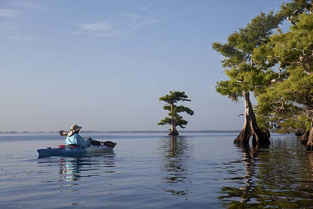
After extensive planning, construction for the Kissimmee River Restoration Project began in 1999 with backfilling 8 miles of the C-38 canal. Three construction phases are now complete, and continuous water flow has been re-established to 24 miles of the meandering Kissimmee River. Seasonal rains and flows now inundate the floodplain in the restored area.
The South Florida Water Management District (SFWMD) and the U.S. Army Corps of Engineers Jacksonville District (USACE) hosted a ribbon-cutting event to celebrate the completion of the construction for the Kissimmee River Restoration Project in July 2021. The Kissimmee River Restoration Project restores more than 40 square miles of the river floodplain ecosystem, 20,000 acres of wetlands, and 44 miles of the historic river channel.This major restoration effort is a 50-50 partnership between the USACE and the SFWMD. Over the past 22 years, the USACE and SFWMD worked together to:
- Complete backfilling of 22-miles of the C-38 canal between Lakes Kissimmee and Okeechobee.
- Reconstruct remnant river channels across the backfilled canal to reconnect and restore flow in remnant river channels.
- Remove two water control structures.
- Add two gates to the S-65 water control structure.
- Acquire more than 100,000 acres of land to restore the river and floodplain.
The Kissimmee River Restoration Project was authorized by Congress in the 1992 Water Resources Development Act. The project will restore 44 miles of meandering river and almost 20,000 acres of wetlands. The restoration project is a joint partnership between the South Florida Water Management District and U.S. Army Corps of Engineers.
The Kissimmee Basin stretches from south of the Orlando area to Lake Okeechobee and is divided into the Upper and Lower Kissimmee Basins. The Upper Kissimmee Basin includes the Kissimmee Chain of Lakes and extends to State Road 60 at the outlet of Lake Kissimmee. The Lower Basin includes the area from Lake Kissimmee to Lake Okeechobee. The area affected by construction for the Kissimmee River Restoration Project includes the southernmost headwater lakes including Lakes Kissimmee, Cypress, and Hatchineha, and the Kissimmee River and floodplain between Lake Kissimmee and Lake Okeechobee.
Construction for the Kissimmee River Restoration Project includes backfilling of approximately one-third of the C-38 canal to reconnect and restore flow to the historic river. Other construction associated with the Kissimmee River Restoration Project includes levee removal, water control structure improvements, flood protection, and various infrastructure improvements within the project area including the headwater lakes. Three backfilling phases are now complete, and continuous water flow has been re-established to 24 miles of the meandering Kissimmee River.
A key element of the Kissimmee River Restoration Project is a comprehensive ecological evaluation program to:
- Assess achievement of the project goal of ecological integrity
- Identify linkages between restoration project and observed changes
- Support adaptive management as construction proceeds and after project completion
The Kissimmee River Restoration Evaluation Program (KRREP) is a comprehensive monitoring and assessment program designed to evaluate ecosystem responses to the restoration project. To detect ecosystem changes, data are collected prior to major construction phases to establish a baseline for evaluating future responses. These baseline data will be compared to data collected after construction and re-establishment of pre-channelization hydrologic conditions. Observed changes in the system will be compared to predictions described by individual restoration expectations to evaluate whether each expectation has been achieved. If an expectation is not achieved, adaptive management strategies may be implemented.
Sustaining and Enhancing the Kissimmee Chain of Lakes
Historically, the Kissimmee Chain of Lakes and the Kissimmee River were an integrated system comprised of headwater lakes connected by broad shallow wetlands and creeks. The Chain of Lakes, like the river, was substantially altered by the construction of the Central and South Florida Flood Control Project. Today, water managers and scientists are working to enhance and protect these habitats for the environmental, recreational and economic benefits they provide.
The Kissimmee Chain of Lakes and Kissimmee Upper Basin Monitoring and Assessment Project initiated in 2010 to address data gaps and knowledge uncertainties identified during the development of the Kissimmee Chain of Lakes Long-Term Management Plan and the 2008-2009 Kissimmee Basin Water Reservations rule development effort. The project includes data collection, evaluation, and reporting activities to support water resource management and protection. Since its initiation in 2010, bathymetric and littoral vegetation data have been collected; water quality sampling has expanded to include additional tributary sample sites; and water and nutrient budgets are under development for major lakes within the Chain.
Kissimmee River: Past, Present and Future
Related Projects and Programs
Listed below are links to initiatives or projects directly and indirectly related to Kissimmee Basin initiatives. The list also includes projects in the interconnected Kissimmee-Okeechobee-Everglades ecosystem with associated benefits to this basin.
- Northern Everglades and Estuaries Protection Program
- Other Everglades Projects
- Minimum Flows and Levels
- Water Reservations
- Water Supply Planning
- Central Florida Water Initiative (Upper Kissimmee Basin Water Supply Plan)
- Central Florida Water Initiative (CFWI)
- Science
- Water Quality Improvement/Stormwater Treatment Areas
- Best Management Practices
- FDEP Group 4 Total Maximum Daily Loads (TMDLs)
- What YOU Can Do
- Recreation
- Florida Center for Environmental Studies – Riverwoods Field Laboratory


