Skip to main content
ASK US
Search site
Search
South Florida Water Management District
Toggle navigation
Who We Are
Governing Board Chairman
Open Government
Governing Board
Budget & Finance Reports
Careers
Contact Us
Our Work
Flood Control
Water Supply Planning
Water Quality Improvement
Ecosystem Restoration
Python Elimination Program
Addressing Blue-Green Algae
Resiliency
Doing Business with Us
Permits
RegPermitting
ePermitting
Right of Way Permits
Procurement
Real Estate
Grants/Funding Opportunities
Community & Residents
Water Conservation
Recreation
Navigation
Education Center
Everglades License Plate
Science & Data
Real-Time Data
Vertical Datum Upgrade
Scientific Publications & SFER
DBHYDRO
Weather
Operational Planning
GIS
Survey Data
Modeling
News & Meetings
News Releases
Public Meetings
Calendar
Speakers Bureau
Photo & Video
Fact Sheets
Contact Us
Careers
Locations
Home
recreation sites
Recreation Sites
Activities
Operator
Is one of
Is all of
Is none of
Is empty (NULL)
Is not empty (NOT NULL)
Airboating
Hunting
Hunting
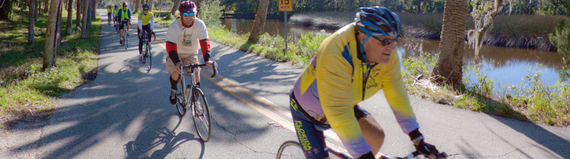
Bicycling
Bird-Watching
Boat Ramps
Boating
Butterfly Garden
Camping (Equestrian)
Camping (Group)
Camping (RV/Travel Trailer)
Camping (Tent)
Canoeing
Education Center
Equestrian Trails
Fishing
Frogging
Geocaching
Hiking
Hunting
Kayaking
Picnicking
Shelters
Stargazing
Swimming
Visitors Center
Wildflower Viewing
Wildlife Viewing
Lookup a Site
Lookup a Site
A-1 Flow Equalization Basin
(
#31
)
Allapattah Flats
(
#16
)
Arthur R. Marshall Loxahatchee National Wildlife Refuge
(
#29
)
Atlantic Ridge Preserve State Park
(
#17
)
Baltic Road
(
#4
)
Blanket Bay Slough
(
#11A
)
Blind Creek
(
#13
)
Bluff Hammock Management Unit
(
#11C
)
Boney Marsh Management Unit
(
#11C
)
C-44 Stormwater Treatment Area
(
#33
)
Catfish Creek
(
#9
)
Chandler Slough
(
#11D
)
Corkscrew Regional Ecosystem Watershed (CREW)
(
#26
)
Cornwell Marsh
(
#11D
)
DuPuis Management Area
(
#19
)
Everglades & Francis S. Taylor Wildlife Management Area
(
#27
)
Frog Pond
(
#28
)
Gordy Road Recreation Area
(
#14
)
Halpatiokee Regional Park
(
#17
)
Harold A. Campbell Public Use Area
(
#22
)
Hickory Hammock Wildlife Management Area
(
#11C
)
Horse Creek
(
#4
)
Huckleberry Island
(
#4
)
Hungryland Wildlife and Environmental Area
(
#20
)
Intercession City
(
#3
)
Istokpoga Boating Facility
(
#11C
)
Johnson Island
(
#6
)
KICCO
(
#11A
)
Kissimmee Prairie Preserve State Park
(
#12
)
Lake Kissimmee: Bird Island
(
#7
)
Lake Kissimmee: Drasdo
(
#7
)
Lake Kissimmee: Eastshore and Westshore
(
#7
)
Lake Kissimmee: Gardner-Cobb Marsh
(
#7
)
Lake Kissimmee: Lightsey
(
#7
)
Lake Kissimmee: Rabbit Island
(
#7
)
Lake Kissimmee: Strum Island
(
#7
)
Lake Marion Creek
(
#4
)
Lake Russell
(
#3
)
Lakeside Ranch
(
#18
)
Lower Reedy Creek
(
#6
)
Loxahatchee River/Cypress Creek Management Area
(
#21
)
Loxahatchee Slough Natural Area
(
#20
)
MICCO Landing
(
#11D
)
Miller/Wild Property
(
#13
)
No Name Slough
(
#11B
)
North Fork St. Lucie River
(
#15
)
Nubbin Slough Stormwater Treatment Area (STA)
(
#32
)
Oak Creek
(
#11B
)
Okaloacoochee Slough Wildlife Management Area
(
#25
)
Pal-Mar East/Nine Gems
(
#20
)
Paradise Run
(
#11F
)
Queen's Island
(
#13
)
Reedy Creek
(
#3
)
Riverbend Park
(
#21
)
Rough Island North and South
(
#6
)
S-65E Impoundment
(
#11F
)
Seaboard Marsh
(
#11E
)
Shingle Creek
(
#2
)
Six Mile Cypress Slough Preserve
(
#24
)
Snell Creek
(
#4
)
Southern Glades
(
#28
)
Spruce Bluff
(
#15
)
Starvation Slough
(
#11B
)
Stormwater Treatment Area 1 East
(
#22
)
Stormwater Treatment Area 1 West
(
#22
)
Stormwater Treatment Area 3/4
(
#22
)
Stormwater Treatment Area 5/6
(
#23
)
SUMICA
(
#10
)
Taylor Creek
(
#11E
)
Telex Marsh
(
#11E
)
Ten Mile Creek
(
#14
)
Three Scrub Sites
(
#15
)
Tibet-Butler Preserve
(
#1
)
Turkey Hammock
(
#11D
)
Upper Reedy Creek
(
#3
)
Water Conservation Area 1
(
#29
)
Water Conservation Areas 2 and 3
(
#27
)
Yates Marsh
(
#11E
)
Find Sites
Matching Sites:
Allapattah Flats (#16)
Allapattah Flats
Allapattah comes from the Seminole Indian word for alligator. But don't let the land's namesake…
Atlantic Ridge Preserve State Park (#17)
Atlantic Ridge Preserve State Park
Take yourself back in time on a hike along the South Fork St. Lucie River. Take care as you…
Blanket Bay Slough (#11A)
Blanket Bay Slough
On the west side of the Kissimmee River is KICCO, which is pronounced kiss-oh. It takes its name…
Boney Marsh Management Unit (#11C)
Boney Marsh Management Unit
Majestic live oaks on either side of the hiking trail offer a welcome as you enter the vintage…
Catfish Creek (#9)
Catfish Creek
From a distance, the border of Lake Hatchineha at Catfish Creek resembles a dramatic, green curtain…
Chandler Slough (#11D)
Chandler Slough
Chandler Slough is a beautiful 3,722-acre tract of cypress swamp, oak and cabbage palm hammocks and…
Corkscrew Regional Ecosystem Watershed (CREW) (#26)
Corkscrew Regional Ecosystem Watershed (CREW)
The Corkscrew Regional Ecosystem Watershed (CREW) spans more than 60,000 acres in both Lee and…
DuPuis Management Area (#19)
DuPuis Management Area
Notifications Posted July 24, 2024: A portion of the Powerline Grade in the Dupuis Management…
Halpatiokee Regional Park (#17)
Halpatiokee Regional Park
Take yourself back in time on a hike along the South Fork St. Lucie River. Take care as you…
Hickory Hammock Wildlife Management Area (#11C)
Hickory Hammock Wildlife Management Area
Majestic live oaks on either side of the hiking trail offer a welcome as you enter the vintage…
Huckleberry Island (#4)
Huckleberry Island
Whether you want to hike a hilly, scrubby area or a flatter but very diverse pine flatwoods, this…
Hungryland Wildlife and Environmental Area (#20)
Hungryland Wildlife and Environmental Area
Closure Notification Posted September 23, 2024: Public access to the road and trail at Gate #9…
Johnson Island (#6)
Johnson Island
Reedy Creek watershed is one of the most diverse and intact watercourses in the area. While…
KICCO (#11A)
KICCO
On the west side of the Kissimmee River is KICCO, which is pronounced kiss-oh. It takes its name…
Kissimmee Prairie Preserve State Park (#12)
Kissimmee Prairie Preserve State Park
This remote and sweeping preserve is reminiscent of western prairies. But here, cabbage palms dot…
Lake Kissimmee: Drasdo (#7)
Lake Kissimmee: Drasdo
Accessible only by boat or airboat, Gardner-Cobb Marsh is the largest District property in the…
Lake Kissimmee: Gardner-Cobb Marsh (#7)
Lake Kissimmee: Gardner-Cobb Marsh
Accessible only by boat or airboat , Gardner-Cobb Marsh is the largest District property in the…
Lake Kissimmee: Lightsey (#7)
Lake Kissimmee: Lightsey
Accessible only by boat or airboat, Gardner-Cobb Marsh is the largest District property in the…
Lake Marion Creek (#4)
Lake Marion Creek
Whether you want to hike a hilly, scrubby area or a flatter but very diverse pine flatwoods, this…
Lower Reedy Creek (#6)
Lower Reedy Creek
Reedy Creek watershed is one of the most diverse and intact watercourses in the area. While…
MICCO Landing (#11D)
MICCO Landing
Turkey Hammock and Cornwell marshes were formally floodplain, converted to pasture. The property…
Oak Creek (#11B)
Oak Creek
Oak Creek has many old-growth oaks, some as large as nearly five feet in diameter, along the…
Okaloacoochee Slough Wildlife Management Area (#25)
Okaloacoochee Slough Wildlife Management Area
The over 35,000-acre Okaloacoochee Slough Wildlife Management Area in Hendry County provides…
Rough Island North and South (#6)
Rough Island North and South
Reedy Creek watershed is one of the most diverse and intact watercourses in the area. While…
Starvation Slough (#11B)
Starvation Slough
Oak Creek has many old-growth oaks, some as large as nearly five feet in diameter, along the…
SUMICA (#10)
SUMICA
SUMICA, once slated for watermelon farming, is the site of a former logging community and sawmill.…
Yates Marsh (#11E)
Yates Marsh
Overhanging oak limbs frame a view of the old Kissimmee River as it winds its way between Telex and…
Site Locations: